PRECINCT BLOOMINGDALE, Jefferson County, Ohio
About
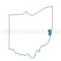
Outline

Summary
| Unique Area Identifier | 648151 |
| Name | PRECINCT BLOOMINGDALE |
| County | Jefferson County |
| State | Ohio |
| Area (square miles) | 0.09 |
| Land Area (square miles) | 0.09 |
| Water Area (square miles) | 0.00 |
| % of Land Area | 100.00 |
| % of Water Area | 0.00 |
| Latitude of the Internal Point | 40.34229410 |
| Longtitude of the Internal Point | -80.81771060 |
Maps


Graphs
Select a template below for downloading or customizing gragh for PRECINCT BLOOMINGDALE, Jefferson County, Ohio